VIKING ENERGY

Tug

FacebookLinkedInTwitterRedditVKPrint

Information related to the Tug vessel VIKING ENERGY (MMSI 232020323, IMO 9868510) from United Kingdom with latest positions and portcalls.

MMSI232020323
IMO9868510
NameVIKING ENERGY
Country United Kingdom
MMSI TypeVessel
TypeTug
Call SignMEPW5
ClassA
Id5ce5ea03a92ccb07a90656ba
Course235.2
Speed (kn)5.4
Heading (°)241
PAC
ROT0
StatusUnder way using engine
Leaflet | © OpenStreetMap contributors

First Seen6 years ago
Last Updatea month ago
Positions602
Latitude14.68452
Longitude-17.414753333333334
Length (m)26
Width (m)12
ETAMar 27, 2021 12:00 AM

Distance travelled (nm)

Since first seen88048.94
Since last port call2832.01
Since last position0.29

Speed (kn) / Draught (m)

OctoberNovemberDecemberJanuary2024

Draught (m)

Current3
Min1.5
Max3.2
Average3.06

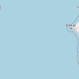
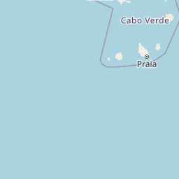
The Tug vessel VIKING ENERGY (mmsi 232020323) from country United Kingdom is currently located at 14.684520 N -17.414753 W and the last position is sent a month ago. At the moment the vessel is Under way using engine heading 241 degree at speed 5.4 knots, and its current draught is 3 meters. The vessel is long 26 m and large 12 m, and it's estimated to be loaded at 0%.

Timeline

The following timeline will display the list of porcalls and other events regarding the ship including tracks.